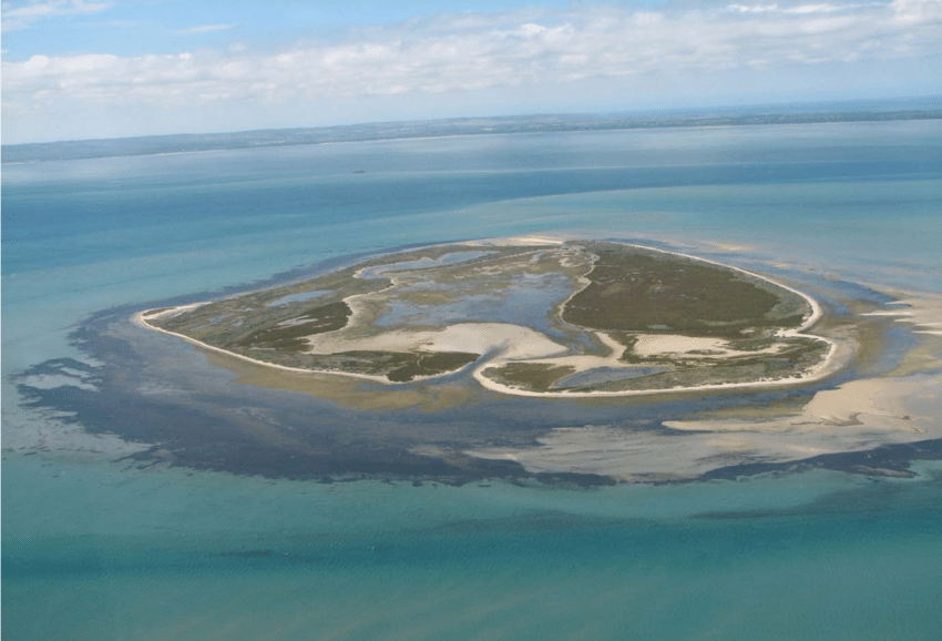
Mud Islands are located about 6km north east of Portsea and are an exposed area of the Great Sands. They are an important part of the Point Nepean Marine National Park.
When you are on a vessel in southern Port Phillip, Mud Islands look like a thin dark line on the water horizon.
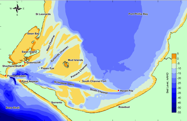
The “islands” constantly change shape due to the effects of strong tides and storms. They have low vegetation including saltmarsh and dune scrubland. The shallows around the island house thick seagrass meadows. There is a lagoon in the middle.
Many species rely on the various Mud Island habitats. It is listed as a RAMSAR site for protection under the International Convention for the Protection of shorebirds. More than 70 species of birds have been recorded to use Mud Islands.
The seagrass meadows and fine muds around the islands are home to a myriad of worms, molluscs and crustaceans that are prey for birds and fish.
The shallows are known to be used by many shark species and bronze whaler sharks use the warm waters to pup.
The microfauna of the sands and mud here and in the bay generally, are critical to keeping the bay healthy. Denitrification processes occur in these sediments, taking nutrients from the water column that could otherwise cause toxic algal blooms.
The Dolphin Research Institute has been caring for our bays and dolphins through Research and Education since 1991. You can support the Institute’s work by donating or becoming an Adopt-A-Dolphin supporter.
